In October, 2015, I visited the Baliem Valley as a tourist for a little over two weeks. I decided to put together a summary of what I learned while there and post it online for other would-be independent tourists, as there is not a huge amount of information available about trekking independently in this area. This is not a comprehensive guide by any means, but hopefully covers the main practical questions the average tourist might have, as well as providing some historical and cultural background of Papua and the Baliem Valley area.
CONTENTS OF THIS SITE
-Historical and Cultural Background of New Guinea/West Papua
-Traveling to the Baliem Valley
-Wamena
-General Trekking Information (equipment, food and water, trail conditions, guides, language, etc.)
-Specific Trekking Route Information
-A Note on Airplanes
-A Summary of My Trip
-Some External Links
I hope this information is useful to somebody, and please feel free to leave a comment or post about your own experiences in West Papua!
NEW GUINEA AND WEST PAPUA
If you are reading this, you probably already have some background knowledge of Papua/the Baliem Valley/New Guinea, but nevertheless, here is a brief summary of the history and culture of the area
.
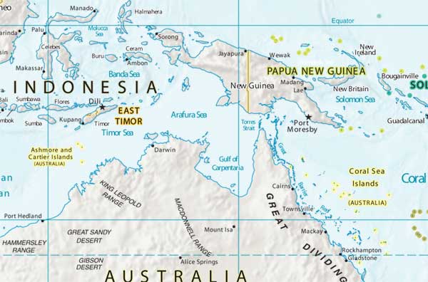
New Guinea is the 2nd largest island in the world, and is located just below the equator, a bit north of Australia. The Eastern half is an independent country called Papua New Guinea, while the Western half is a part of Indonesia, and has been since the early 60's, when the Dutch gave up their colony to an independent Indonesia. It used to be one province called Irian Jaya, but today is split into two provinces, West Papua and Papua (where the Baliem Valley is located). Most local Papuan people, being ethnically and historically unrelated to Indonesians/Malays, deeply resent Indonesian rule, and almost unanimously desire independence. The coastal people of New Guinea had plenty of contact with other groups of people, participated in maritime trade, were visited by western missionaries as early as the 16th century, etc. The Central Highlands, however, remained entirely out of contact with any people outside of the highlands (including coastal New Guineans) for years untold, primarily due to the difficulty in traveling through the hundreds of miles of dense forests and swampland that separated the Highlands from the coast.
This all changed in 1938, when a plane flew over the Baliem Valley for the first time.
The Westerners in the plane were shocked to see tidy agricultural developments in the valley supporting a sizeable population, having previously assumed there were only mountains and possibly some small bands of hunter gatherers. They dubbed it "The Grand Valley," first contact was made, and newspapers around the world announced the newly discovered "stone age people" living in the remote mountains of New Guinea. But then WWII and other things got in the way, and no sustained contact was made with New Guinea Highlanders until the late 50's/early 60's. Into the 1970's, there were still many uncontacted tribes living deep in the mountains.
Missionaries came first, followed by Anthropologists. The missionaries evangelized, were enourmously successful, and today basically 99% of Papuans are Christian of one variety or another. The anthropologists wrote books that are much more informative than this summary. One that I read and found interesting is called "The Dani: Peaceful Warriors," which was written by an American who lived with the Dani during the 60's for a few years, and there are plenty of others.
Almost total isolation from the outside world gave rise to extremely distinct cultures, but isolation from the outside world was only half the story. Different tribes were isolated from each other as well, due in part to the extremely rugged terrain, characterized by steep mountains, dense forests, and wet weather, as well as intertribal violence, which could prevent some groups of people from venturing out of their home valleys for long periods of time. As a result, there are hundreds of different tribes, and more than 800 different languages have been recorded here (accounting for about 10-15% of the total number of languages in the world).
The traditional dress/undress of the area is perhaps the best-known aspect of the culture. Although there is much variation among groups throughout New Guinea, Baliem Valley-area men generally went naked except for a penis gourd (called a koteka), and sometimes liana vine hoops around the midsection, and women wore either grass skirts, bark loincloths, or other coverings of their lower bodies according to marital status and tribe, but otherwise went naked. Additionally, highlanders used a great amount of jewelry, piercings and other body adornment, worn everyday to an extent, but especially during ceremonies or war time. This might include pig tusks, bones, sticks, feathers, etc., stuck through pierces noses and ears, colored mud smeared on the body or into the hair, body painting, etc etc. However, few people dress in this way today.
 |
| A Dani man |
 |
| Traditional Yali Attire |
 |
| Dani men preparing for a ceremony |
I didn't take these pictures, nor did I see anyone dressed in this elaborate fashion. I did see many men in just their kotekas, and some women wearing nothing but loincloths but the majority of people wear western clothing... t-shirts and shorts, etc..
Most people in the highlands are farmers, and their main crop is the sweet potato. Rather, it is a tuber that is often called a sweet potato.... it is not like the sweet potatoes you find in Western markets, and since it seems to have been here for quite a long time (given that they've been farming for thousands of years and had no contact with other cultures until 70 years ago), may be a separate, endemic species. As far as I can tell, it's a bit of a mystery. Some people say the Portuguese introduced it in the 16th century, but there is no recorded contact with Highland people, so the evidence is a bit scant.
 |
| Sweet potatoes growing on a hillside |
Pigs are extremely important as markers of social status, and are frequently traded and gifted among friendly groups, and eaten at festivals, ceremonies, funerals, etc., typically in pit barbeques. Cannibalism was also practiced by some groups as part of their method of warfare, as recently as the 1970's.
Although the Highlands were one of the very few places in the world to independently develop agriculture (and apparently a sophisticated, very successful form of it, at least for sweet potatoes), Highland cultures developed little technology. There is no metal to be mined up there, nor much good clay, and as such, no metal tools or pottery were used (hence the "Stone Age culture" references). No large mammals apart from pigs meant no beast of burden that could be used for transportation or farming, and few native crops meant a heavy reliance on sweet potatoes (which makes up about 90% of the diet). Extreme topography meant that there are few roads in mountainous areas even today. Limited in these ways, people used stone, bone, and wood to make tools, weapons, and houses, and life revolved around farming, pigs, ceremonies, and warfare.
The area has changed tremendously in the last 50-60 years. The introduction of Christianity is a huge change, and like everywhere these days, people are able to access more information than ever before. Traditional dress has largely been supplanted by cheap Western-style clothing, planes supply remote villages with instant noodles, and a huge proportion of people smoke tobacco, which simply wasn't available until contact with the outside world.
However, the Highlands remain a very interesting cultural destination, and offers some very demanding, yet rewarding trekking routes that allow you to meet friendly people in remote places.
THE PEOPLE
In the lower part of the Baliem Valley, including Wamena, the main ethnic group is the Dani people. In the upper part of the valley, there is a closely related group, the Lani (formerly called the Western Dani by anthropologists). To the southeast, you find Yali people, though most of them live over a mountain range, in an area called the Yalimo/Jalemo. The Yali are the most traditional people in the area in terms of dress, but it's still only a small segment of the population that doesn't wear Western clothing. Beyond them live the Mek people, but most people will not trek far enough to see the Mek. Further out from the valley, there are several other groups.
You can also trek to visit the Korowai people in the southern lowlands, who build incredible treehouses and maintain a very traditional way of life, but I think that's pretty far (4 weeks roundtrip?) and you most definitely need a guide.
The Dani/Lani/Yali people (and possibly the Mek, but I know nothing about them) are also divided into a number of different clans within the tribe, and warfare was a regular part of life for many centuries, both between and within tribes. Battles tended to be less lethal than, say, European battles, but were an integral and formalized part of the culture with accompanying rituals and practices.
These days, tribal conflict is rare in the Baliem Valley area. There are still occasional incidents, but it is usually between two villages or families or smaller groups within the tribes, rather than, say, the Dani vs. the Yali. This relative peace and stability is probably the most positive result of Christianization, if you ask me. Also, as demonstrated by this mural in Angguruk, the introduction of modern medicine (such as antibiotics) went hand in hand with the missions, and was undoubtedly helpful in converting the masses (that's a syringe that he's holding up to the heavens).
 |
| Saving souls |
Members of different tribes will often speak to each other in Indonesian, the lingua franca of the area, and paradoxically, find intertribal solidarity in their mutual resentment of Indonesian rule.
In my experience, people were mostly very friendly. Hand shaking is common practice here among both men and women, and I shook hundreds of hands in my 11 days on the trail. Greet them with a friendly "Waa!" and shake their hands as you pass each other, they will almost certainly smile and shake your hand in return..
THE CULTURE
The Highlands' geographic isolation resulted in the development of some very unique and interesting customs. This is most obvious in their way of dressing and adorning their bodies, but those practices are rapidly dying out. I've seen almost as many naked people walking the streets of San Francisco as I did in the Baliem Valley. Apparently, this has changed pretty quickly, and as recently as the 15 years ago, almost everyone still wore traditional dress. But no more.
The culture has changed a great deal in the last 60 years. It's undeniable. However, despite most tourists focusing on the recent adoption of western clothing, Christianization has been the biggest force for change. Missionaries have been in the region for decades, in even the most remote regions, living with the people, learning the languages, and gradually changing some significant aspects of the culture. Finger-cutting, sexual norms, cannibalism, tribal conflict, as well as traditional dress... all of these things have changed in a large part because of Christianization. This is not to mention the new technologies, food and other products, tobacco, medical treatments, etc., that have been introduced since modern contact. The age of the internet, cheap flights, and more and more Highlanders spending time away from the Highlands (i.e. studying or working for a few years in Jayapura) have also contributed to change, giving some Papuans access to economic and educational opportunities that simply did not exist before.
That being said, this does not mean that the culture has disappeared or been destroyed. On a superficial level, the people do not look as different as you might expect if you read a bunch of National Geographic articles from the 80's just before your trip, and yes, a guy who lives a three-day walk from the internet asked me to send him a picture on Facebook, but in many ways, the culture remains unchanged from centuries past. People still eat a 90% sweet potato diet, which they farm in the same way they have for centuries, they live and sleep in traditional huts (known as a "honai") in small villages, and still follow many of the same social practices, values, customs, and ways of thinking that they have for a long, long time.
 |
| This guy has a Facebook account |
Remember that getting further away from Wamena doesn't mean you'll find more traditional culture, so don't trek out to Mek country expecting to find a bunch of bone-wearing cannibals. Missionaries made it there first, and you'll be sorely disappointed.
If you really want to see a lot of Papuans congregating with bones in their noses and gourds on their dicks, you should come in August, when there is a big festival, and all the various tribes get dressed up and perform traditional dances and mock battles. This is supposed to be the busiest time in the valley for tourism, and you are well-advised to book your hotel room and flight long in advance.
If you want, you can organize tribal dances/ceremonies to be put on for your entertainment and cultural enrichment at any time of year. Some people talk badly of these, but I don't think there's anything wrong with them, they're a legitimate way for locals to make money and the dances are real, traditional culture even if the particular enactment you witness is being performed as a show... But they're pretty expensive, at least a million Rp for an hour-long show, and more if you want food (a lot more if you want to slaughter and eat a pig).
You can split this cost between several people though, and remember that pigs are expensive for locals, too. Paying a few million rupiah for a pig may well be close to the local price. Depending on size, a little piglet will go for 1-2 million Rp, the biggest and fattest ones can for for tens of millions of rupiah (a couple thousand USD).
TRAVELING IN THE BALEM VALLEY AREA GETTING THERE
The only way to get to the Baliem Valley is to fly there. Most people fly to Jayapura/Sentani, the main airport on the north coast (Jayapura is the biggest city but the airport is actually located in Sentani), then fly into Wamena, the biggest town in the Baliem Valley, 30-40 minutes away by plane.
These flights can easily be booked online, either directly through the airlines (sometimes) or through Nusatrip.com. However, I believe you have to fly to Jayapura from another Indonesian city, like Jakarta, Makassar, Denpasar, etc. There are no direct international flights as far as I know. I flew from Denpasar to Jayapura on Garuda Airlines, then up to Wamena on Trigana Air. There are a few others that make the trip to Wamena (Wings/Lion Air, Susi Air, XPress Air).
It is also possible to take a Pelni ship to Jayapura. Google for more info.
THE BALIEM VALLEY AND WAMENA
When you fly into Wamena, the valley below you looks like any other agricultural valley you might find anywhere else in the world. It's very green, and you see lots of square fields in the characteristic patchwork pattern of man-made gardens. The valley is pretty big and flat (80 x 20 km, roughly), surrounded by mountains on all sides, and it would take quite some time to explore all of it.
 |
| The Baliem Valley from the plane |
Wamena is a modern invention of the Indonesian government. It has an interesting mix of Papuans and Indonesians, and you'll see some people walking around in kotekas and other traditional (un)dress. But apart from that, it is not a terribly charming place, just another dusty town with bad (or no) sidewalks, arranged in a grid layout. Almost all the businesses seem to be owned by Indonesians, and 90% of local Papuan economic activity is in the form of selling stuff on a blanket on the sidewalk or driving a bicycle rickshaw.
Getting around the city is not hard. You can walk to anywhere central in 20 or 30 minutes, and otherwise there are plenty of ojeks (motorcycle taxis) and bicycle rickshaws that will charge you 5,000-20,000 Rp for most destinations. There aren't really sidewalks on many streets, but lots of people walk. The airport is right next to the center of town, you can easily walk to your hotel if you can carry your stuff. For further destinations, there are bemos (shared minivans) around that are cheap and fairly reliable. Ask someone where bemos to your destination usually wait, they all have different spots.
 |
| A Street in Wamena |
There are plenty of restaurants in town, but none are particularly outstanding that I found. There is also a supermarket, a few internet cafes that have slow but somewhat reliable connections, a (relatively) decent bakery, and some traditional markets. Jibama Market is the biggest, and is worth a visit. Lots of fruits and vegetables, some traditional crafts, a meat market featuring some oddities like dog and couscous (an endemic forest rodent, kind of like a ferret, no idea how you spell it), a fish market, a few guys walking around in kotekas, a lot of trash on the ground... It takes about an hour to see it all. Take an A2 Bemo from the center of town for 7,000 Rp, or walk. It's about 40 minutes from the town center by foot, take the road behind the airport and follow it northwest.
There are several "traditional art shop" places where you can buy crafts and traditional artifacts for similar prices as Jibama market. They are Indonesian run, but actually, they often have a better selection than Jibama, which only has a few stalls selling traditional crafts.
There is also an internet cafe called Papua.com (pronounced "papuacom") that is run by a Japanese guy who apparently has a ton of experience trekking in this area. If you plan on doing a less conventional route, you might want to try him and see if he can give you any information, although I didn't talk to him myself. He sells a mostly decent map of the area, but you can get pretty much the same map for free at the tourist information office. They'll give you several copies of it, and it's worth taking more than one with you on the trail.
Everything for sale in Wamena that is not grown in the Baliem Valley is relatively expensive. For example, bottles of water are 20,000 Rp instead of the usual 5,000. It all has to be flown in, so as much as possible (within your luggage weight limits), bring everything you need.
Alcohol is not allowed in the Baliem Valley, though I've heard that it's tolerated for tourists to bring in a small amount.
PLACES TO STAY
Wamena is not especially friendly to the budget traveler, particularly when it comes to accommodation. There are a number of hotels in the city, but they are generally expensive (at least 400,000 Rp a night), and of poor quality. Paper thin walls, stereos blasting from 5:30 am, dirty, no hot water, etc., etc.
Fortunately, there are two decent options, both of which have pretty recently become available at the time of writing (October 2015).
Most recommended is a homestay run by Markus, a German-Italian, and his wife Thea, who is a local Wamenan. You can find them on AirBnB, which should be easy since they are the only AirBnB hosts in Wamena. They charge 150,000 for a bed, including breakfast and a hot water shower, and are most friendly and hospitable. It is especially recommended to stay here if you plan on trekking, because they can tell you lots of information about the area, routes, the latest news and changes, etc. They both speak good English, have traveled a lot in other countries, and are generally pretty interesting people. They also have a few books about the local culture and area that were interesting to read, a bicycle that they will let you borrow, and they even let me leave a bag of stuff there while I was on my trek. Markus will likely meet you somewhere central when you get in, then take you to their house.
I stayed there during my first couple of days in Wamena, and would have stayed there again when I got back, but they had a baby while I was trekking and were a bit too busy to host anyone at the moment. However, they have plans to expand their operation in the coming months (as early as December, 2015), possibly even opening up something like a proper guesthouse, so look them up.
The second option is a small guesthouse run by the local community center. It's 250,000/350,000 a night (s/d) for a clean, basic room on a quiet street, including breakfast, hot water, and free internet from 5-9 pm (and 10,000 per hour at other times). The family running it are friendly and helpful, and they also have a bicycle you can borrow. It is a bit hard to find, since it has no sign, but maybe they will fix that problem eventually. They've only been open for 4 months so far....
From the airport, it's maybe a 10 minute walk. Go down the main street (Jl. Jos Sudarso), make a left on Jl. Thamrin, then a right onto Jl. Diponegora. The guesthouse is on the left side of the street about 100-150 meters down, shortly after a distinctive reddish-brown wooden house and a pale green building with several living units in it. The building is white, with a brown metal roof, the gate may be closed, and it certainly doesn't look like either a guesthouse or a community center, just another house on a quiet street. On the roof, it says "Hogorasuok," which is the name of the guesthouse, but it's a bit hard to see where this is written because it's under a small, overhanging part of the roof and is partly blocked by a tree. Hopefully, they will just put up a sign.
You can also call them at 0969-32382, or email them at puskomwamena@gmail.com
TREKKING IN THE HIGHLANDS
Overview
There are a couple things to keep in mind when trekking in this area. One is that you are very far from any medical attention, and there are no roads in the main trekking areas. Don't break your ankle.
Another is that the Baliem Valley/New Guinea Highlands are historically remarkable because these were the last densely populated, agricultural societies to make contact with the rest of the world. Therefore, you are not usually hacking your way through the jungle, many days away from any settlements. You could do that in some parts of New Guinea, for sure, but if you are in the main trekking areas, you will see lots of people and regularly pass villages. This is true even in more distant places, like the Yalimo or Mek country, though you will pass through uninhabited stretches on your way there.
The terrain can be pretty brutal at times, but then again, that's half the fun. Especially if you make it to the Yalimo or take some less-traveled route, you will often be walking up or down incredibly steep and narrow trails, making your way on roots, melon-sized rocks, sticks embedded in the muddy trails, and/or wading through mud puddles, all of which can be slippery and treacherous. You will climb over many little wooden ladders and slanted logs with little notches cut into them, cross streams on slippery, rotting logs, use your hands to climb up small rock walls, etc etc.
 |
| The trail through a forested section |
 |
| Haphazardly arranged sticks are often used to make muddy trails passable |
 |
| Frequently, the trail will descend down to a river, then climb right back up the other side |
 |
| Steep, rocky trails are the norm in some areas |
That being said, in other areas, you'll just have to walk up or down a few hills. The trail from Kurima to Kiroma is like the main highway of the region. Although there are some pretty steep hills (especially climbing up to Yogosem), the trail is always easy to see, sometimes visible for a couple miles as you look down the valley, and for most of the way the trail is wide and well-maintained. There are always people around, going to and from Wamena and their villages, and you can ask directions all the time.
In that area, you definitely don't need a guide to show you the way (though you may consider hiring one for other reasons).
You might get turned around a bit leaving some villages, as there may be several paths leading out of the main area. But it's a village, so there are certainly going to be people around, and you can easily ask someone which way to go. Kids will often follow you for 10 minutes or so and make sure you find your way (usually expecting some gula-gula for their troubles). Also note that there will be many stone fences in the villages and on the trail, with wooden ladders or slanted sticks that you use to climb over. It's fine to cross these (you have no choice in most cases), they're just to keep pigs out, so you don't need to worry th at you're trespassing, etc..
 |
| A typical stone fence crossing |
The weather can be hot and/or rainy, it gets pretty cold at night in the higher villages, and thick clouds may envelop the whole top of the mountain in the evening. But it rarely gets to freezing temperatures, and on the whole the weather is not too bad. It was especially dry when I was there (I only got mild rain once), but I gather that even when it rains regularly, for most of the year it's not torrential downpours, but more like a steady rain for a couple of hours, then it clears up again, or sometimes it rains all night but clears up during the day, etc.
In any case, more rain means more mud, which means slower progress on the trails, so keep that in mind if you're there during a rainy time.
SURAT JALAN
Until recently, trekkers needed to get a "surat jalan," a travel permit, issued by the police either in Sentani/Jayapura or Wamena. Markus told me that you no longer needed one for the Wamena region. When I began my trek, I stopped by the police post in Kurima to double check, and sure enough, they did not require me to have one They just wrote down my name and passport number and I was on my way.
If you trek to Angguruk, you are entering another prefecture, where supposedly you still need a surat jalan. I didn't have one, and nobody ever asked me for it (the only Indonesians I saw were a few nurses and builders who were working in Angguruk, never any police presence). I would expect you could always play dumb and then pay to have one "issued on the spot" if anyone really wanted it, but I don't know.
If you are worried about it, seek more information elsewhere, but I wouldn't worry about it too much.
EQUIPMENT AND SUPPLIES
Trekking in the Highlands, you should definitely have the following things:
- Good boots and a couple pairs of wool socks (or really tough bare feet)
- A decent sleeping bag (It can get cold at altitude... a bag rated to 0 degrees C should be fine).
- I would bring a sleeping pad, too, since you often sleep on the floor.
- Something for the cold nights (a jacket, sweatshirt, etc., but you probably don't need a hat, gloves, etc.)
- Rain gear and a change of dry clothes
- A flashlight
- A map
- 3 to 4 liters of water-carrying capacity
- Some basic first-aid stuff.... bandages, antibiotic cream, ibuprofen, something for blisters (I just had gauze and tape, it worked fine), iodine for water if you need it. There are no medical supplies out in the villages.
- Some gifts for the locals (i.e. instant coffee packets you can share, matches, cigarettes, pens, medical supplies if you know what you're doing and speak fluent enough Indonesian to explain their use to the locals, etc)
For clothes, I had shorts and a shirt for hiking, pants and two shirts for not hiking (which I wore at the same time to keep warm at night), three pairs of underwear which I rotated, and a couple pairs of cotton socks for camp. So not much.
That's most of what I had, and all that you really need.
Additionally, I had an Indonesian phrasebook, flip flops for the end of the day, a baseball cap, a camera, and a toothbrush/toothpaste. I had my passport, too, and a good bit of cash, which I suppose is also necessary (certainly no ATMs out there...). However, I left my bank cards and other document-type stuff in Wamena, and a copy of my passport may have been enough.. I also brought a good amount of food, which I would strongly recommend (see below).
I didn't need bug spray at all (really didn't see any mosquitoes), nor did I need sunscreen, but I don't burn that easily. The sun does get pretty strong at altitude, so if you burn a lot you might want to bring some.
Also, the nights are pretty long (about 12 hours of darkness), and most villages don't have electricity. People hang out around the fire pits for a bit, but not that long, and if you want to read or write in your journal or just not sit around in the dark, you'll need your own light. I bought a candle in Hitugi for 5,000 Rp, it was very handy and lasted for several nights.
Very little equipment can be bought in Wamena, so you should come ready to trek. In fact, it's hard to find gear of any quality most places in Indonesia, so as much as possible, you should bring it from home.
WATER AND FOOD
Water is not too much of a problem. There are enough sources along most trails that you don't need to carry all that much, though you should ask locals to make sure. I had two 1.5 L bottles that I filled up on a rotating basis, and that was fine. I had another 1.5 L bottle that I kept empty in case I hit a stretch where I needed it, but I never did. It was quite dry at the time I was there, too.
For water safety, you have several options. You can brave the streams and try to seek out the springs, and if you're smart about it you are probably gonna be okay. There are certainly some springs, as well as high streams with no villages above them that should be fine for drinking. Ask locals where you can drink and use your own judgment if you are comfortable doing that.
Alternatively, you can get boiled water in the villages. But you might not get as much as you want, and it's a bit of a hassle if you have to wait for it to cool down.
Finally, you can filter or purify your water with your own means. If you have a pump filter, Steripen, etc., it's probably worth it to bring it. Or you can just use iodine. Iodine tablets are hard to find in Indonesia, but you can use Betadine (provodine iodine), which is cheap and available in pretty much any Indonesian pharmacy. That's what I did. It's not ideal, it says "for external use only" on the bottle, but it works fine and seems safe enough to my basic understanding of chemistry. 4 drops per liter, wait for an hour, put in 50 mg of vitamin C per liter AFTER waiting for an hour to get rid of the flavor.
In other circumstances, I would happily drink straight from a spring or high creek. However, I really did not want to get sick on my trek, both because I have a very limited opportunity to come here and didn't want to lose valuable time, and also because hiking back to town up and over steep hills for 4 days with the runs sucks. So I erred on the side of paranoia and put iodine in everything. You can make your own choice.
 |
| A woman preparing a traditional pit barbeque in Angguruk |
As far as food goes... Bring as much food as you're willing to carry. You don't really need to bring any, but sweet potatoes and instant noodles get pretty old pretty fast (and no matter how much food you bring, you're still gonna eat an awful lot of sweet potatoes if you're out for a long trek). I brought a loaf of bread, a couple cans of tuna, lots of peanuts, oatmeal, some chocolate, some Nescafe 3-in-1 packets, several packages of instant noodles...
The cans of tuna were definitely worth it. Yeah, they're heavy, and you have to carry the can around afterwards if you want to be a good tourist (though locals have no problem littering on the trail), but man, they were some of the only good protein I got for days and made for a great lunch. I ate them during the first few days, when I was least accustomed to the trekking life and really needed the energy, put the cans in a trash bag in my pack and forgot about them. Indonesian cans of tuna come often come with spicy sambal mixes that are actually pretty good.
You can pretty much always get potatoes, and can buy noodles and perhaps coffee in many villages. (ask if there is a kiosk in the village). You will also see people selling stuff potatoes along the trail every once in a while. Occasionally, you can get other stuff, mostly bananas, cucumbers, and sugar cane (which is great for hiking), sometimes cabbage or corn.... I saw a couple avocado trees, too, but none for sale in the villages.
I highly recommend asking for the sweet potato leaves (daun ubi), which are pretty good, and make it a lot easier to swallow the dry potatoes.
If I did it again, I would bring more instant coffee packets (I drink a lot of coffee), and I'd bring something to eat with the plain, boiled sweet potatoes you're sure to get. At least a little salt, maybe some chili flakes or dried herbs... something. Indonesian-style sambal goes great with them if you're willing to carry a little bottle of that around.
If you are paying 50,000 for food as part of your accommodation deal, that generally includes sweet potatoes, the leaves and/or other green vegetables, and the cost of cooking them, both for dinner and breakfast. Try to clarify this as much as possible, that your price includes both the food AND the cooking. I had this agreement in writing once, and the guy still tried to bump me up an extra 50,000 the next morning by claiming that I had only paid for the food but not the cooking. I'm not sure if he was just trying to milk me or if there was a genuine misunderstanding, but why not make it clear beforehand if you can. Anyway, if you buy sweet potatoes from a farmer on the trail, they are super cheap, roughly 5000-10,000 for 3 big/5 small ones, so 50,000 really ought to cover the cooking fee as well (they just boil them for you, it's not all that much work and they're usually just cooking dinner for themselves and making enough for you).
Also, if you want noodles in addition to your potatoes, you will have to supply them yourself or pay to buy them from the kiosk.
If you really want to save money, I suppose you could bring/buys your own food that just requires hot water (ie. instant noodles, oatmeal, etc.) and skip the potatoes and cooking fee each night. But the potatoes are hearty and filling, and taste good as long as you can eat them with something, like the greens or in a bowl of noodles... It's just when they're served plain and boiled that they're bland and tiresome.
 |
| A typical village |
SLEEPING
Most (but not all) villages will have some place for tourists to sleep. If there is not a normal place for it, you could probably ask to sleep in the church or in the cooking hut or something, but typically you will sleep in a wooden, western-style building on the floor. It will not be a really nice place, but it should be okay. You may get a thin mattress or carpet on the floor, and they can probably provide you with some blankets if you need, but these may not be enough for the cold if you're up high. Some places have bedbugs, so I'd recommend using your own sleeping gear as much as possible.
 |
A typical room for sleeping |
You can probably sleep in a honai if you wish, perhaps even for free in the men's room (if you are a man) or the honai of whoever cooks for you, but I wouldn't recommend it. When I travel, I generally like to live like the locals, but I couldn't really handle the honais. There are no chimneys, so the whole room fills up with smoke. A LOT of smoke. I mean, there's a campfire burning in a round room about 5 meters in diameter and 2.5 meters at its tallest point, with nowhere for the smoke to go except out of a tiny door close to the ground. It gets reeaaal smoky in there, it's hard to breathe, it burns your eyes, and I found it intensely uncomfortable for sleeping. Some honais are better than others (better ventilated), and obviously it depends on the size of the fire. The locals just hang out in clouds of smoke as if it's nothing, often smoking cigarettes at the same time. I have asthma, which further exacerbated my discomfort, but I reckon most Westerners would not be too happy in there.
Unexpectedly, a number of villages have very basic and limited electricity, supplied by nifty little solar panels attached to the roofs of their honais. This was enough to power weak lights at night, charge their phones, and (unfortunately) power loudspeakers that were sometimes used to blast music throughout the village.
I am sure the following villages have rooms: Kilise, Ugem, Hitugi, Yogosem, Kiroma, Ninia, Sobaham, Syokosimo, Userem (this is actually a collection of villages, some of them may not have a room but they're all close together), Wesagalep, Bukam, Wamarek, Tangma, Angguruk, Mimbaham, Wemput, Kosarek. I would also bet a lot of money that Yuarima has a place, but never got that verified. There are also smaller villages along the way that may or may not have rooms, you can always just ask someone.
GIFTS
It is common practice for tourists to bring gifts with them to the villages. Most commonly people bring pens, coffee/tea/snacks, matches, candies, cigarettes, pictures from home, etc. These do not need to be expensive gifts, and no one will get mad if you don't have something for them, but it is very common and some locals expect it to a certain degree.
For me, it was a nice way to break the ice. When you arrive in a village, you can share some coffee or cookies with your host, or offer them a cigarette if you like, they will almost certainly take it. Kids mostly want candy (and cigarettes, but they aren't gonna get any from me). I brought Mentos, so I could give out 10 candies without having 10 wrappers end up on the ground, and gave them sparingly, to kids who had been cool to me and with whom I had interacted more than just a few minutes passing by. I brought pens and matches, too, which I left with friendly hosts and my guides.
In general, I didn't just give out gifts to anyone I met on the trail. It had to be someone who hosted me, or was friends with my host, or with whom I had a real interaction. Sometimes locals will just come up to you and say, "Bule!" (white person), then motion for a cigarette, particularly in the areas closer to Wamena. That's rude, and I am not the Santa Claus of tobacco and I often ignored these people completely (or just shook their hands with big smile and kept walking without acknowledging their request). But most people don't ask for it, even if they suspect you might give them something.
One thing that could be a good gift is an empty plastic water bottle. I gave one of mine away at the end of the trip, to much appreciation, and a couple people had asked for one before (but I still needed them myself at that point). I was really surprised by how little water my guides drank on the trail, and it is partly due to them not having plastic bottles readily available. It seems like they could pretty easily buy a drink in Wamena and reuse the bottle.... but I don't know, I only saw very small bottles being used.
GUIDE OR NO GUIDE??
Guides in the Baliem Valley can be very expensive if arranged ahead of time through a tour agency that charges a ridiculous premium, moderately priced if you find one independently upon arrival, or pretty cheap, if you find one that doesn't speak English in a village outside of Wamena, or if you jus tag along with local people who are going back to their home village or something. At the higher , I've read about guides charging 700-900,000 per day (plus you pay food, sleeping, etc.). A guy I met with an English speaking guide he met athe airport was paying 350,000 per day, plus food/sleep. I paid 150-200,000 per day (plus food) by tagging along with Indonesian-speaking locals and carrying my own bag. Additionally, a 10-15% tip is customary at the end of the trip.
Note that guides will usually be able to sleep for free in the villages.
Porters to carry your bag can also be arranged for remarkably cheaply. That same guy I met with the English-speaking guide had also hired a porter for 60,000 Rp per day (less than $5 USD). I saw some other tourists on the trail who had a guide and porter for every tourist, which is really not necessary. Your guide may try to convince you that you need to pay for a porter and cook and someone to file your nails for you while you sleep, but you probably don't need any of that. The guide can carry your bag if you like, and can cook for you in the villages (it's mostly just boiling potatoes and instant noodles, after all)
However, unless you're going to the Yalimo or other faraway destinations through uninhabited stretches of forest, you probably don't need a guide. If you are used to trekking with a full pack, you probably don't need a porter. Personally, the whole idea of having a porter makes me uncomfortable, but I am still a relatively young man, and I may well feel differently in a few decades (probably depressed that I actually require one).
As I have said, in the Mugi River Valley, the trail is really clear and easy. Only get a guide for that section if you want one for cultural reasons. Otherwise, learn a little bit of Indonesian (enough to ask for food, a room, and directions) and you'll be fine. The trails around Userem-Wesagalep-Bukam can be harder to follow, but I was fine. Being comfortable with basic Indonesian is more important in that area though.
If you don't speak any Indonesian and don't learn some before going, you won't be able to talk to anyone without a guide. Even if you speak basic Indonesian (enough to find your way without a guide), you may prefer to have an English speaking guide so you can ask more questions about local culture, etc. It also may smooth relations with local villagers when you arrive with a guide (though in my experience most people were still friendly when I showed up alone, and many commended me on my supposed bravery or whatever (though this is due to perceived Western incompetence rather than real bravery on my part; Papuan children regularly hike the exact same paths, carrying supplies back from Wamena).
The point is that you may prefer to get a guide even if you don't really need one for the area in which you're trekking.
Further afield, you are more likely to need a guide. I had a guide from Kiroma to Angguruk, and that was necessary. Especially during the Mt Elit passage, and the forested areas between the pass and Angguruk valley, I couldn't have done it alone. There are lots of little paths in the forest and you can't see where they lead at all due to the dense vegetation. Sometimes we'd pass a tiny little path and my guide would say, "Oh, that's the path to Waniyok" or wherever, and without him being there I would either have walked right by it without seeing it, or been unsure which fork to take. You don't meet as many people there, either, since there are no villages between Kiroma and Peliam, which constitutes about 10-12 hours of trekking. However, from Angguruk to Kosarek, I was told that the path is pretty clear and there are a good amount of people walking on it, so you could probably do that without a guide.
Another section where you'd definitely need a guide would be between Ninia and Waniyok/Angguruk. It's uninhabited and forested, so good luck finding your way without someone who knows the area. I didn't travel in this area, but from what I heard, you can probably make it up to Ninia without a guide. It depends a lot on how comfortable you are hiking, looking at maps, asking directions when you do run into people, etc. I was also prepared enough with food/sleeping stuff that I could have camped wild for a night and been okay (though this would've been a lot more difficult had it been a rainier time of year), so I felt confident that I could backtrack and find a village in a worst-case scenario.
Some guides rip tourists off.... bump up their rates midway through the trip when you are totally dependent on them, inflate prices of supplies, make up excuses to extend the trip an extra day or two... One guy tried to pull this on me when I was leaving Kiroma for Angurruk (you can read about it below), and there are plenty more stories on the internet about that, so be careful. Clarify any gray areas with regard to prices/fees/number of days you expect to be trekking with them, get it all in writing, etc. Insist on paying per day rather than a lump sum at the start of the trip, go with your guide when he buys food or supplies and pay for them yourself, etc.
If you would like a guide for lighter hiking and for other activities around the Baliem Valley, I can recommend a very friendly man named John. He spent a year and a half living in the US through his church, speaks pretty solid English, and is a real nice guy. I stayed at his house on my last night before heading back to Wamena and talked to him quite a bit. I'm not sure if he could lead longer hikes due to a leg injury (though I reckon he's probably more nimble than a lot of older Westerners), but for shorter, less strenuous hikes, or as a cultural interpreter, helping to arrange other activities in the valley, etc., he'd be a good and honest choice. Maybe he knows other reliable people who can led longer treks, too. I have no idea what he charges, but it's probably pretty reasonable.
Here's his email: John_defrico@yahoo.co.id **OR** Defricomeage@yahoo.co.id.
You can also find him on facebook under John Meage **OR** Defrico Meage.
 |
| John and me |
LANGUAGE: INDONESIAN
It's true that in the main trekking areas, you don't need a guide to show you the path, but almost no one speaks any English, so you had better know a little bit of Indonesian if you go alone! I spoke zero Indonesian upon arrival in the country, but I had a month to travel around in other areas and learn as much as I could before I went to Papua. I had a Lonely Planet phrasebook (which is decent for sentence building and such, but is best supplemented by an English/Indonesian dictionary).
I learned as much as I could during that month... memorized vocabulary words, wrote down new phrases, tried to talk to people, etc...and that got me enough that I could take care of all my basics and have some fun conversations. I was an okay student, but honestly, I could've been better.
Luckily, basic Indonesian is pretty simple, and mostly requires you to memorize vocabulary words, since the grammar and sentence construction are not very complicated. I speak in a broken way, for sure, but I could generally say what I wanted to say, ask what I wanted to ask, etc. The bigger problem was that I didn't always understand the response unless it had to do with the basics (food, shelter, directions, etc). My Indonesian was largely practical, and was inadequate in certain social situation.
I wish I could have spoken better, it would have been more fulfilling socially and culturally, and it was sometimes taxing to speak a foreign language I scarcely knew after a long day on the trail. But as far as being able to get from A to B and eat a hot meal when I got there, it was enough, and it was cheaper and I was more independent than if I had hired a guide. I was able to have real conversations with people so long as they spoke a bit slow and stuck to certain topics.
Another thing to note is that many English-speaking guides have pretty basic English skills, so they may or may not be very helpful if you want to have more in-depth conversations about cultural issues, the independence movement, etc. Unless you speak great Indonesian, try to do your research before coming so you have some more context. For example, I wished I knew more about the problems between local Papuans and the Indonesian government, the struggle for Papuan independence, etc., because many, many people wanted to tell me about it, but I couldn't understand all of what they told me and I have only a rough understanding of the situation.
LANGUAGE: DANI AND YALI
Dani and Yali languages are completely different than Western languages, and are apparently very complicated. I read in that "The Dani: Peaceful Warriors" book that Dani verbs can be conjugated in over 1600 different ways, with all kinds of information packed into them (i.e. if an action is something that a person does habitually there is one form of the verb, if the action is done spontaneously or out of character, there is another form of the verb, etc). I don't really know much about it, but anyway, nobody expects you to learn Dani.
However, if you can at least greet people in their own language, they will probably like you more, so here is how to greet a(n) _________ in Dani:
Old woman (grandmother age): Nagosa (NAH-go-sa)
Middle aged woman (around 30-50): Nausa (NOW-sa)
Young woman (about 15-30): Na-Logo/Na-Loko (short stop after the "na," and a hard, glottal "g" sound in "logo")
Old man (grandfather age): Nopase (NO-pah-say)
Yound and middle aged man (about 15 and up): Nayak (NA-yak)
Children (prepubescent): Adik
You can also use "Waa" (pronounced like the "wa" in "water") with everyone... men, women, Dani, Yali... "Nare" (NAH-ray) is also a common greeting for everyone, particularly among the Yali. Adik also seems to be used sometimes as a term for an adult who is younger than the speaker (At least, I was called adik by older men a few times, and I'm 29). Groups of children will sometimes make fun of you by greeting you with the wrong word (effectively calling you an old woman or whatever is (in)approprite for you), but it's usually done in a friendly spirit.
A few other Dani words and phrases:
Thank you: Haloek
See you later: Lan
Ka la luk? : Where are you going? ( a common greeting)
Nerok: Nice to meet you (if talking to a woman)
I also learned the words for good morning, good afternoon, etc., but every time I said them, locals just responded with the Indonesian equivalents, and actually, I heard locals greet each other in Indonesian all the time.... So it doesn't seem worth it to write them here.
NUMBERS, TIME, AND QUANTIFICATION
Traditionally, most groups of people in this area did not really have numbers. They had words for 1, 2 and 3, and after that it was just "many." They did not have clocks of any kind, and though you do see them sometimes these days, they are almost never accurate, and many are broken or out of batteries. Some people have a clock on their phone, but rarely look at it, preferring to estimate by the sun (though in my experience, they weren't particularly accurate when checked against a clock). Almost nobody I asked knew how old they were, how many people lived in their village, how many students attended the local school, etc. It's just not a particularly numbers-oriented culture.
Bear this in mind when asking how long it takes to get from one village to another. You can ask 10 people and get 10 answers, or even just ask one person several times and get several answers. Sometimes people would change their estimates literally within seconds, saying it took 4 hours to get to X, then a few sentences later saying it would take 6 hours, with no apparent reason for the increase. Walking from Syokosimo to Wesagalep, I got estimates ranging from "two hours, or one if you walk fast" to 10 hours!! This was asking several different people during the first half hour out of Syokosimo. Oher people had told me 3 hours, others 5.... It was impossible to know what was true. It ended up taking me about 5 hours, though I think I took a slightly longer route than I needed to (I took the road towards Bukam for a time, rather than going through Kapagalo).
Anyway, "one hour" does not mean one hour. It means something like, "longer than about 20 minutes, but probably less than 2 hours." People will often say things like, 'If you leave early in the morning, you'll get there in the early afternoon." It's all pretty rough.
Furthermore, the person you ask may or may not have ever walked that way personally (so they might not really know), might be significantly slower or faster than you, or may be adjusting the time for you, the slow Western tourist, to varying degrees of accuracy.
So take all estimates of a numerical nature with a large grain of salt.
One tip when asking directions is to ask for the next village on your route, rather than your final destination for the day. There are sometimes multiple routes, and if you just say, "Does this road go to ____?" they might truthfully say yes, without mentioning that there is a shorter, more direct route you could take instead.
Also: My estimates and reported times also may not be right for you. I'm a fairly young man in decent shape, I have a good deal of trekking experience and a penchant for trekking long hours. I usually prefer to be on the trail most of the day, stopping regularly along the way at nice viewpoints, to have a chat, etc., but generally going as far as I comfortably can each day rather than hiking for 3 hours to the next village and hanging out for the rest of the day. My time estimates include the time I spent taking water breaks, having a snack, resting after a climb, talking to locals, etc. I don't consider myself particularly fast among experienced hikers, but I'm not slow, and I've often noticed that I am actually kind of fast compared to people who don't do a lot of hiking/trekking. You may well be different than me, and should estimate times for yourself accordingly.
ROUTES
There are a number of possible trekking areas around the Baliem Valley, including the Mt Trikora/Lake Habema region and the cloud rainforest around Yorimo, but most people head to the southeast section of the valley, beginning their trek in Kurima. In other areas of the valley, the roads run for up to a hundred kilometers, but here the road stops less than an hour outside of town, and it's just trails from there. This is where I spent all of my time, and is the focus of anything I write here.
Depending on your preference, you could do a day hike or trek for weeks. You can trek all day, or just for a few hours to the next village. There are many possibilities.
For me, the highlights were crossing from Kiroma to Angguruk via Mt. Elit (a brutal two days), and the area around Bukam/Wesagalep. These areas had the best scenery, and came the closest to what I heard about Papua before coming here, namely, punishing climbs and descents, thick forests, lots of mud and slippery logs and all of that. These sections also had the best views or mist-covered mountains and steep, deep valleys. People are a bit more traditional in the Yalimo as well, but not by a whole lot. You see more traditional dress, and these people are less likely to spend time in town cuz it's so far away, but it's not dramatically different.
Regardless of your route, beginning your trek will start out in much the same way if you plan on exploring this southeastern area. From Wamena, walk or take an ojek to Wouma Pasar (Wouma Market), then find the bemos to Kurima. They'll probably be on the left side of the street. The bemo won't leave until it's full, and should cost 20-25,000. It takes almost an hour to get to Kurima, or rather, to the point at which the road has been washed out shortly before Kurima (the road used to go all the way to Tangma). From there, it's a half hour walk down to the bridge where you cross the Baliem River. The police post is shortly before the bridge, you should probably check in there just to be safe.
At that point, it depends on if you're goign up the Mugi or towards Wamarek. If going up the Mugi, cross the bridge across the Baliem, immediately climb a steep hill to Seima (it goes up to the left fromt he bridge), then ride the ridge back to the right towards Ugem. If going towards Wamarek, you have to go back up the hill then make a u-turn up the hill. There are a lot of villages around, so just ask every person you come across which way to Wamarek and you should be fine (you follow the old dirt road until Tangma, so it's kind of impossible to lose once you're on it...)
SOME POSSIBLE ROUTES
 |
| My hand-drawn map of the area, based off of the free map I got at the tourism office but with some extra villages and features marked. |
A day hike to Wamarek or to Hitugi could be nice for a short jaunt and a taste of village life. Hike out, spend the night, come back the next day. Hitgui is about 3 or 3.5 hours from Kurima, Wamarek is a bit more.
For an easier 2-4 days of hiking (depending on your speed), you could do something like Kurima-Seima-Ugem-Hitugi-Yuarima, possibly going as far as Yogosem. This route takes you up the Mugi River valley, and the path is quite easy to navigate and generally well-maintained. Once you have climbed up past Seima, doesn't have any serious climbs until after Yuarima. You can either just go back by the same route, or make it a bit harder/longer and going from Yuarima to Syokosimo/Userem and going back that way. The climb and descent to Syokosimo is more demanding, and the path is harder to walk on (very narrow on a steep hill, a bit overgrown).
For a more strenuous, but more visually rewarding 2-4 day hike, I would recommend doing a loop through Kurima-Wamarek-Wesagalep-Userem-Seima (?)-Kurima (I'm not exactly sure where you cross from Userem, but I know it's possible... You might cross the Baliem and go back through Kilise instead of Seima. Double check before you head out.). You could extend this by a day by going to Bukam on your way from Wesagalep to Userem (about a 3 hour climb from Wesagalep, through some cool forest... a bit harder to see the trail though). You can do this loop in either direction.
A longer option would be hiking to Kiroma and back again. Depending on your speed, that would take you 4-7 days. MAKE SURE that if you go alone, you turn left onto the Kiroma trail about an hour and a half out of Yogosem. It cuts off to the left, and is mostly made up of logs that you walk across for half an hour. It's not hard to see. But if you go straight, you'll end up in Ninia, so if you've been walking briskly out of Yogosem for longer than about 2 hours, you should double check with someone tha you're on the right road.
Another good 4-7 day hike would be a combination of both of the 2-4 day hikes described above: Go up the Mugi to Yuarima, then cross and come back down to Syokosimo, then go through Userem to Wesagalep, and back to Kurima through Wamarek and Tangma. I think this is a better option than hiking to Kiroma and back if you are up for climbing some hills. You get a bit more variety (not just following the same river the whole time), and the views from Wesagalep are quite nice. However, there are also fewer people on this trail, particularly the stretch between Wesagalep-Bukam-Userem, so a bit of Indonesian would be useful for getting directions.
You could extend the above hike by a couple days by hiking from Yuarima up to Kiroma and back again. You can do this route in either direction equally easily.
Longer routes mostly involve heading toward Angguruk or Ninia. From Kiroma it's 2 big days or 3-4 smaller ones to Angguruk, and 1 big/2 smaller days to Ninia. There's also a path from Wesagalep to Ninia (Wesagalep-Bukam-Werima-Soba-Silakman-Ninia) that I think takes 2-3 days. I did not go there though, so check with other sources. You can also go past Ninia and go the longer-but-easier route to Angguruk, through Waniyok. You'd need a guide for that after Ninia.
ANGGURUK AND THE YALIMO
Locals typically do the Wamena-Angguruk route in 3 days, sleeping in Yogosem and Abiange on the way. But they're pretty fast.
Going to Angguruk from Kiroma, you have a couple of options for scheduling. I did it in 2 days, but that involved one big 7 to 8-hour day and one ridiculous 11-hour day. It was fun, but you could break it up into 3 or 4 easier days if you prefer. From Kiroma to the pass takes 7-8 hours of steady hiking, but you don't want to sleep on the pass... it would be very cold. So you either stop and sleep after about 6 hours, or continue down the other side for a 10-12 hour day. You need a guide for this section, or you can do what I did and tag along with Angguruk locals on their way home (you still pay them, but it's cheaper, and I like that they aren't really doing anything special for just my sake). The route goes basically like this:
From Kiroma, you go up the river for about an hour, then cross it and turn up a stream. You follow the stream bed for a steep 2 hours, perhaps longer if you're not going that fast, then walk through some up-and-down scrubland and forest for another hour before you start climbing again at a more gradual pace.
The gradual climb takes another hour or two, and on the way you pass a few places you can sleep.
There are two lean-to shelters about 15 minutes apart from each other (this area is referred to as Pelantera), very basic but adequate, and another place called Wonggul. There is a big cave at Wonggul, and I think you sleep in the cave, but I am not 100% sure... It was pointed out to me as we passed by, but the cave is down from the trail a bit and we didn't actually go down there. In any event, all these places are fairly high altitude (around 3200-3300 meters, I reckon), and sleeping there could be a bit chilly. There is water at Wonggul, as well as on the stream on the way up, and another less-tasty spot up closer to the pass.
 |
| A lean-to shelter on the way up the pass |
Before you hit the pass, you get to a plateau covered in tree ferns, which takes 30-45 minutes to cross if the mud isn't too bad. There's a lot of mud, and if it has recently rained a lot, it may well take twice that long to cross it. Then you're at the pass, and shit starts getting epic.
The descent is extremely steep, literally vertical at times. There are wooden ladders nailed into the rock face. They are mostly pretty sturdy, but there are a few sketchy spots, and there's no telling when a nail might pull out, or when a partially rotted rung might get pushed beyond its carrying capacity. People do die there sometimes, both locals and tourists, and it pays to go slow and be careful, especially as you will likely be tired from many hours of trekking by the time you get there. If the weather has been rainy, I would very seriously consider timing the descent to match the driest part of the day, even if that means spending more time/money.
In between the ladders (there's only maybe 8 ladders) are some arguably more treacherous sections of very steep descending on slippery rocks. I had to catch myself a couple of times, the rocks can be really slippery when wet. A serious fall here could really do some damage. The descent is also really tough on the knees... they take a real beating.
 |
| A sketchy wooden ladder on the far side of Gunnung Elit |
It takes another 2 hours to really get down the descent. You are still descending after that, but it gets much less steep and you enter the forest. There is a fairly large forested area here, with several honais scattered throughout the forest that serve as free accommodation for travelers, collectively referred to as Abiange. No one lives in the huts permanently, there is no village, but the shelters are regularly used by locals. In fact, they might be full by the time you show up! To find them, you need a guide or need to be willing to wander around the forest for a couple of hours and possibly come out somewhere unexpected.... the paths are small, numerous, and totally unmarked. From the bottom of the descent to a honai could take as long as an hour.
From Abiange, you can go towards Peliam and Pronggoli, two nearby villages that are the first Yali settlements you come to, or you can bypass them and go straight to Angguruk. Peliam/Prongolli are in one valley (the Sibi River), Angguruk is in another (the Yaholi River). You climb up and down a series of steep hills, then go through another forested section, still climbing and descending.
The forest both here and in Abiange is really cool, real dense and jungly. The path is truly atrocious at times, and you can marvel at how much better really tough bare feet are for this terrain compared to the awkward Western hiking boot and wool sock, and gawk wonderously at the local skill for balancing on slippery logs and roots while running downhill.
 |
| A view of Angguruk Valley |
Eventually you come out the other side into Angguruk valley, which has a whole bunch of villages (and one American missionary from the 7th Day Adventist church who is trying to get his Yali flock to stop eating pork.... good luck with that, buddy). You may be able to stay in one of them if you don't want to go all the way to Angguruk, but I don't know for sure. From there, it takes roughly another 3 hours to Angguruk, and although the path is mostly pretty clear, there are still a few grueling climbs and descents.
Angguruk is the largest Yali village, and the main seat of the local missionary presence (the KKE church, which dominates the whole region). There is a German guy name Klaus Reuter AKA Papa Klaus, who has lived there on and off for several decades. He has a guesthouse there that is a little too comfortable... there are chairs and wood floors and real beds and a sit down toilet. There is electricity, too. He wasn't around when I was there, so I can't say much about him, though I heard that he's not particularly welcoming to tourists.
What I can say is that it's more expensive than in other villages, and maybe not really how you want to spend your time in Papua. It's 150,000 per night, plus 30,000 for the services of the caretaker, Ibu Selina (so really, it's 180,000 per night), plus another 50,000 for food/cooking, and I supplied much of the food (i.e. instant noodles, which she then cooked for me). At the same time, I felt too comfortable there... It was nice, after 4 days of hiking to get out there, to have a rest day in a comfortable house, drink some coffee in a western-style living room, etc., but then I felt like I was missing out on a more Papuan experience. Nobody else sleeps in beds out here, so why am I?
I stayed there for three nights (longer than anticipated due to some scheduling issues), and I don't think there's anywhere else to stay in Angguruk. Papa Klaus is beloved by the locals, and as a tourist/westerner, you would naturally be expected to stay with the other westerner in town. If you do stay there, look at the photography book published by his daughter (who grew up in Angguruk in the 80's) for great photos of traditional dress, farming techniques, ceremonies, warfare, etc.
 |
| The guesthouse in Angguruk |
I would have stayed only 2 nights, but Angguruk has a market every Tuesday and Thursday that I wanted to see. It ended up being somewhat interesting, but nothing too special. Everyone is selling pretty much the same fruits and vegetables, and there was a pig being cut up and sold piecemeal for outrageous prices (3-4 ribs and the accompanying backfat was going for 500,000 Rp!! ($35 USD)). You see the same stuff and the same amount of people wearing traditional dress as at Jibama Market in Wamena. So check it out if you're in Angguruk at a convenient time, but don't lose any sleep over missing it.
On a side note, I think it would be interesting to be in some of these villages around Christmas, Easter, etc. These folks are pretty religious and there might be some cool stuff going on.
Going past Angguruk across the Yalimo takes you to Kosarek, the last major settlement before entering Mek Country. The route takes 2 big days, or 3-5 smaller days. The route goes Angguruk-Helariki-Mimbaham-Teman-Wemput-Kosarek. Locals typically sleep in Wemput on a 2 day trip, but you could also sleep in Mimbaham on the way for a three day trip. I got conflicting information about villages where you can sleep between Wemput and Kosarek, and I didn't personally end up doing this section due to an airplane scheduling fiasco (see below). As far as I understand though, the path to Helariki is a bit sketchy (some forest, more ladders, but nothing like Gunnung Elit), and after that it's pretty clear and there are lots of people around, so you may not need a guide. But I can't guarantee that and take no responsbility for anyone who gets lost/killed trying to do that guideless.
If you like trekking fairly hard while also enjoying the culture and scenery on the way, and have ambitions to make it to Kosarek and back on foot, I would budget at least three weeks in the Baliem valley area... 2 days to get ready in Wamena and go to the market, 4 days to Angguruk over Gunnung Elit, a rest day, 2-3 days to Kosarek, a rest day there, 2-3 days back to Angguruk, perhaps another rest day there or in another nearby village if you need it (and you will, if you're going back over Gunnung Elit), 4 days back to Wamena from Angguruk down the same Mugi River valley route, then a day back in Wamena to rest before catching your flight....So 18-20 days in total. You could also take the longer route one one leg through Ninia, which I think takes 5 or 6 days instead of 4, so there you go, three weeks. It would be prudent to budget a few extra days, just in case something unexpected comes up...
AIRPLANES?
Ideally, I would prefer not to backtrack on treks, either by doing a loop or a through-hike to another destination. Airplanes are one way you could potentially avoid backtracking in New Guinea, hiking to some remote location (i.e. Kosarek), then flying back to Wamena. There are airstrips in many villages, even in some very, very remote places.
I tried to do this, but I failed. You might fail, too, even if you are three times as organized and diligent about it as I was. The biggest lesson I learned is that airplanes might be feasible, but you shouldn't rely on them unless you have a lot of time to kill and don't mind waiting.
I hiked to Angguruk, and was hoping to go to Kosarek and back in 6 or 7 days, then fly back to Wamena from Angguruk in time for my flight back to Jayapura. Despite my skepticism, I was assured multiple times by many people on the way there that there were planes everyday. In Angguruk, I tried to confirm this, and was very informally told that I could get a flight on my preferred day (a Monday, as it happened), no problem at all. The next day, the night before I was to begin trekking to Kosarek, I tried to confirm this in a more formal way, and the situation turnd out to be very different.
Long story short, the local guys in Angguruk had absolutely no idea about the flight schedule... planes definitely didn't come everyday, they told me there were never flights on Mondays, and there was little to no organization with regard to flights or passenger lists, etc. They have an old, barely functioning radio they can use to contact Wamena and other airstrips, and that's about it. It was impossible to get any concrete, reliable information, and in the end, I couldn't risk getting stranded there and missing my flights back to Jayapura/Bali. So I left the next day, and walked back to Wamena, unfortunately skipping the Kosarek leg of my trip (but going through Userem/Wesagalep instead, which was also nice).
I ran into a British pilot on the day of my return to Wamena, who said, "Angguruk? I was just there this morning. We have a contract to fly there every Monday, I'm sure I could've taken you." I don't know if the guys in Angguruk truly didn't know that, or had some other reason they didn't want me to fly that day (locals do get priority, obviously), or if they just didn't want to deal with me... In any event, I didn't get that information in time for it to be useful to me.
You could try to arrange a flight before leaving Wamena, but even then there is a risk. Bad weather or strong winds could delay your flight, the company may decide anothe route is more urgent and delay your flight by a day, some other problem could come up, etc. It's all so tentative, and I wouldn't rely on it unless you have many days to spare.
There are several companies that do charter and cargo flights in the area, notably the MAF (missionary airlines), Susi Air, and Trigana. This includes flights from various villages to Wamena, but also direct to Sentani, or to Dekai, in the south, which could work fine if you don't have any stuff to pick up in Wamena.
 |
| The sloped runway in Angguruk. The hill helps slow the plane down on the relatively short runway |
SUMMARY OF MY TRIP
I arrived in Wamena on the morning of October 6th, slept two nights at Markus and Thea's place, then hit the trail around noon on the 8th (it takes some time to drive out there). From Kurima, I walked to Hitugi in about 3 or 3.5 hours and slept there. You basically climb up from the river, then ride the ridge for a few hours. The next day, I made it to Kiroma in about 7-8 hours. It's a harder day, with some serious climbing from Yuarima to Yogosem, and many people choose to sleep there rather than continue onto Kiroma. In both villages, I slept in a room in a local house that I found by asking the first person I came across in the village if there was a place for me to sleep, and paid 100,000 for the room, plus 30-50,000 for food and cooking.
This whole section was very easy to navigate, I met lots of people on the way I could ask for directions, but really, there's one clear path, so it's hard to get lost. You are following the Mugi River valley, and in many sections, you can see the trail winding along the ridge for a kilometer or two in the distance. Many locals were still surprised to see me walking alone, and several people tried to convince me to take them on as a guide or porter.
In Kiroma, I asked my host if there was someone who could guide me to Angguruk, and he volunteered himself. I asked how much, and he said 100,000 per day, but later bumped this up to 200,000 a couple hours later. That was still quite a reasonable price, so I said okay. We agreed that I would pay his fee, plus food, shelter, and cigarettes, and that we'd take two days to get to Angguruk, sleeping at Abiange or Peliam on the way. I planned to give him an extra day's pay for the walk back.
The next morning, we were due to leave at 7. He got his bag all packed, put on some trekking clothes, tied a bandana around his head, then at 7:05, told me that actually he couldn't go because he had to help with some function at the church (which had somehow slipped his mind until just then...). But not to worry, his friend could take me.
The friend wanted 300,000 per day, and I said no. I didn't much like this bait-and-switch business, and dug in on the original agreement. He said okay, but clearly wasn't happy about it. After we'd been walking for a 5 or 10 minutes, he started saying that it was too far to go to Angguruk in 2 days, it might take 3 or even 4 days, at which point I stopped walking and said, basically, "Look, what's the deal? Do you want to do this or not?" He again agreed to continue, but things were a bit tense and I was wary of the prospect of climbing a mountain with a guy who doesn't like me.
After an hour, we came across some Angguruk locals on their way back home, and he basically passed me off to them, which was fine with me. We very quickly discussed terms, and it was settled: 200,000 per day, Angguruk in two days, I pay for food and we sleep for free in Abiange. Done.
My new guide was about 35-40 years old, and was traveling with an older guy probably in his 50's, and his two boys who were roughly 13-14. They all had a bunch of stuff they'd bought in Wamena and planned to use or sell in the villages... clothing, soap, oil, cigarettes, etc. The kids had little interest in me, the older guy was always lagging way behind us, and my guide talked really fast and it was difficult to understand him, so we mostly just walked.
We made it over the pass and down to Abiange by nightfall, but to actually get the the hut, we had to bust out the flashlights for about half an hour. They acted like this was normal, so I guess it happens sometimes.
The first hut was full, so we had to keep looking. We'd run into another group of people on their way back from Wamena in the same situation (men, women, children), and we all ended up in the same hut. It was very nice at first, warm and cozy, and everyone was friendly to me despite wondering what the hell I was doing there. I gave them all cigarettes and oreos, the surest and quickest way to build goodwill, and we ate instant noodles cooked on the coals in the plastic packaging (which works pretty well if you don't mind the cancer).
I tried to sleep in the honai with them, but it was extremely smoky and hot, and they were all having a good time, making a lot of noise, so eventually had to move outside and sleep under the stars. They thought I was insane, and I didn't know how to say "to breathe" in Indonesian, so I mimed wheezing and explained that I had asthma, but they still seemed confused. I slept all right though. Luckily for me, it wasn't too cold, and the morning dew was not an issue.
The next morning we got up at 5:30 and started off again, stopping by my guide's hut near Peliam to drop off his stuff. We ate breakfast there, the other went their own way, and my guide and I set off for Angguruk. Once the road became clear, I paid him and sent him home since I knew he was planning on going back to sleep in his friend's village halfway between Angguruk and Peliam.
I walked the last bit to Angguruk alone, and came down into the village to a friendly reception. I got my room sorted at the missionary's house, and hung around the village until bedtime. My boots were absolutely haggard by now (don't buy cheap shoes...) and my feet were kinda messed up, so I was happy to sit around.
The next day was my rest day, and as it happened, a Dutch couple who were involved with the KKE church flew in for a 1-day visit. They were friendly, it was my first time speaking a lot of English in a few days, so it was a nice day. They had some experience here, having lived in Sulawesi for 8 years and visited Angguruk once before, in the late 90's. I went on a nice little hike in the hills above Angguruk, the villagers had a pit BBQ of sweet potatoes and bananas with bloody red pandanus pulp squeezed on top (it looks much better than it tastes), and I enjoyed the lack of pain in my feet.
The next day was market day, so I checked that out in the morning, then made plans to go to Kosarek. The Dutch people flew back to Wamena. At this point, I was still under the impression that a plane was a reliable possibility, due to the assurance of every single person I had asked about it, but by the evening, I found myself reflecting on how informal it had all been, and how generally unreliable other information I'd been getting was (Person 1: It's only 2 hours to Mimbaham.... Person 2: It's about 7 or 8 hours to Mimbaham...). So I decided to go to the airline office (a shack next to the runway with a lot of cigarette smoke and an old radio that mostly made unintelligible space noises) to double check my current standing and gauge how reliable this plane might be.
Unsurprisingly, nobody seemed to have any idea about my supposed flight, or really, any flights at all. Nobody could tell me anything definite, except that there were no flights on Sundays or Mondays (which turned out to be wrong). Realizing how unsure my flight back to Wamena was, I had to cancel my Kosarek leg and head back to Wamena the next day.
Ibu Selina, the caretaker at the missionary's guesthouse, assured me vehemently that there was a plane tomorrow ("For sure! For sure!" she said). I could take that, then do another trek somewhere else. Of course, there was no plane the next morning, and Ibu Selina was totally nonplussed. That sort of thing happened many times on my trek, information changed rapidly and without explanation, and the person acted as if nothing had happened, despite their earlier confidence.
It was still early, maybe 7 am, so I started looking for a guide back to Kiroma. I found one almost immediately, and we quickly discussed terms (most people don't have formal jobs, so if they can make a few hundred thousand Rp in a few days guiding a tourist, they'll often be willing to leave their potatoes and other business while they make the easy money). He suggested 150,000 per day plus food, and I agreed. Then he ate breakfast and got his bag together, and within 40 minutes, he was ready to go.
Then he changed his mind. He said he couldn't go alone, because it was dangerous for a Yali to be alone in Dani country. This was never truly corroborated by anyone else, except for Ibu Selina, who was standing right there and strongly agreed. Now worried that I would never get out of Angguruk, I said, "Okay, that's fine, get a friend to come, too, and I'll pay both of you 150,000 per day." Or I offered to go with him all the way to Wamena, where he said it would be safe for him. But he hemmed and hawed for a long time, refusing to be consoled or to let the problem be solved, and eventually decided that he just didn't want to do it and walked off.
By now it was almost 8:30, and if I wanted to get to Abiange at a reasonable time, I should get going. Fortunately, there were two guys standing right there who were about to leave for Wamena (literally with their bags on their backs, ready to go). I said I'd pay both of them 150,000 a day plus food, and that I would carry my own bag, and they said sure. Easy money for them.
So off we went. At first they confirmed the Dani-Yali feud (we talked about it for like 10 minutes, I
asked a bunch of questions about it, and they consistently claimed there were problems), but then later completely backtracked and said there were no problems whatsoever. It left me pretty confused, honestly. My Indonesian is not very good, but these were simple questions, and I'm sure I was speaking and understanding correctly. I later learned that tribal animosity is not common at all, but sometimes individual clans, villages, or families might have some kind of dispute that can turn violent. So maybe my would-be guide was embroiled in some kind of beef over a pig (disputes are usually about pigs, women, or gardens), or maybe he was just weird, I really don't know.
Anyway, the news guys were fine. We slept in Abiange again this time in a honai with lots of cracks inthe walls that let the smoke out. I slept with my head next to the door, and we kept the fire small. It was okay for my smoke-wise, but they had nothing to sleep in or keep warm... one sweatshirt between them.... and once the fire died down, they were screwed. I figured they'd keep it going all nights, but in the middle of the night I woke up to find them both sitting awake smoking cigarettes. They said they were too cold to sleep, and I felt like a pampered jerk in my sleeping bag and jacket.
Confused about why the fire was so small, I told them they could make the fire bigger, that the smoke wouldn't bother me, etc., but they said there wasn't enough wood, so I gave them my flashlight to go and find more wood, and gave my jacket to the one with no sweatshirt. They made the fire bigger and got a little bit of sleep (but not much). I guess they were expecting those conditions though, they'd been literally walking out the door on their way to Wamena when I approached them about being my guides.
We ascended Gunnung Elit the next day, a real beast of a climb, like 3 hours of walking up tall stairs with a (mostly) full pack, then down to Kiroma. It was a long day, but not as long as crossing the pass in the other direction. Actually, it was a good 2 or 3 hours shorter.
From Kiroma, I was reluctant to back track any more than I had to, so the next day I trekked to Syokosimo. By now, my boots were unusable unless I did something. The insoles had completely disintegrated, and I was walking on a crosshatch pattern of rubber that was killing my feet. I put my second pair of wool socks int he bottom, which actually worked pretty well, and allowed me to keep hiking for another 2-3 days.
Syokosimo felt like I was back on the tourist trail. Several people wanted to sell me things and swarmed around me on my arrival, selling coffee, bananas, kotekas, axes....a kid grabbed my hand and told me my friend was staying in his house (I had met another tourist in Kiroma who was also planning on staying in Syokosimo that night, but we didn't hike together, and I was looking for him when I arrived in the village), but that was BS... just a kid trying to hustle me. My host was okay, but the food that I supplied for dinner (that I really wanted to eat, I was quite hungry) was actually going to feed several random villagers who had turned up as well, one of whom kept trying to get me to buy him stuff.
It was all very off-putting. I hadn't really experienced anything like this in Papua up to that point. I didn't buy anything (I didn't want any of it), took as much of my noodles as I could (which was most of them), and didn't really talk to anyone during dinner. Perhaps I was being cheap or petty, but I didn't like this feeling that I was being milked... A tourist is here and he's gonna buy us all dinner, whether he knows it or not.... But then after dinner, they all turned very friendly and we sat around talking for an hour. They mostly spoke slowly and were patient with me using my phrasebook to look up words, all of which makes a huge difference in terms of how well I can communicate with people in Indonesian.
The next morning was the same, that same guy kept trying to get me to buy him stuff. It was so clearly just to get money out of me... he wanted me to buy bananas for him from some lady, and after I repeatedly refused, he just ate them anyway without paying her! She didn't seem to mind. I ignored him as much as possible, then finally said "I don't understand, you want me to buy food, then you eat it. You did the same thing last night. No." Then he left. Several other people came through and they were all very friendly. I generally had a lovely morning, and sat around talking and drinking coffee til around 9, during whcih time I got an incredible variety of estimates for how long it was going to take me to walk to Wesagalep.
From Syokosimo, I climbed up to Userem/Wuserem and rode a ridgeline for a while. Userem is actually a collection of many villages, not one single place, and there were some very extensive and impressive potato fields along the way. Everyone was friendly as usual, and continually pointed me down the main trail (which was quite wide in most places) to Wesagalep.
I was expecting to go through Kapagalo on my way there (according to the map), but at some point a guy said no, Kapagalo was down the mountain. I was on my way to Wesagalep all right, but I was also on my way to Bukam. Im not sure if this was the best way to go, or if my map was just inaccurate (it was on many other points), but in any case, it was too late now, and I could still make it to Wesagalep. From the last Userem village, I climbed a really steep hill, then descended like 300 meters, then climbed another 300 meters up another very steep hill.
The trail turned into the forest, and suddenly there were multiple trail options splitting off from the trail I was on. Nobody had mentioned these when I'd asked directions, but I knew I generally had to get over the hill and go down to the right, so I guessed as best I could. There were no people around by now, and because of the amazing range of time estimates (1-10 hours), I was really not at all sure how far it was to Wesagalep. It was only about 2 pm, but I started to hurry.
Finally, I saw a solitary hut in the distance, and practically ran to it. Luckily, there was a guy sitting in front of it when I arrived. He assured me that Wesgalep was close, one hour away and gave me a bit clearer directions. Half an hour later, I could see it a few hundred meters below me, and all was well.
I was tired and not feeling too social in Wesagalep and it's a pretty small village, anyway. One guy living there told me there were 460 people living there, but there's no way.... There are only like 10-15 houses, maybe 25-30 if you include another nearby village. I only saw maybe 25 people the whole time I was there. I played with some kids for a while, washed my socks, and ate dinner alone.
The next day I was headed back to Kurima, where I planned to sleep one more night before returning to Wamena. I descended a massive hill from Wesagalep down to the river then back up a much more mild hill on the other side to Wamarek. It was a Sunday, and people were dressed up and going to church. This was the case in every village I passed that day, and meant that I met a lot of people, since they weren't out in their potato fields working. I shook so many hands. People in the Baliem Valley area really are quite friendly and welcoming most of the time.
From Tangma, the trail becomes a dirt road. It was hot and I was in no hurry, so I stopped in the shade for a while, and eventually made a fire in a fire pit and cooked lunch - instant noodles cooked in the bag. You see lots of fire pits along the trail, and people use them all the time, but still, the sight of a bule making a fire caused passersby to gawk and stare and ask me if I was okay.
I made it back to Kurima, only to find that there was no place to sleep. I had heard about one guy doing it, but I guess he happened to ask a guy who was willing to put him up in his house. I had to walk to Kilise, another 30-40 minutes down the river away from Wamena. I'd really been looking forward to taking dip in the river at Kurima, but it wasn't possible.
On my way to Kilise, I met John, the guide who I recommend above. He was very excited to meet an American since he had lived there for a while, and we chatted for a few minutes before I continued on. 20 minutes later, I passed through a very small village, and asked if there were any rooms. There were, and I settled in for the night. A couple of hours later, John came by. It turned out that I was staying in his brother's house! So we talked for quite some time, and then I went to bed.
The last morning, I had fresh sambal with my sweet potatoes, which was about 1000 times better than plain sweet potatoes. Really quite good, actually. Then John and I walked back to Kurima, along with my other tourist friend who I'd met in Kiroma, who spent the night in Kilise.
We caught a bemo back to town, and that was pretty much the end of it. I spent another couple days in Wamena, buying some souveniers and eating food that wasn't potatoes or instant noodles, then flew out to Sentani/Jayapura, then back to Bali the next day.
I had no real problems with my flights to and from Wamena, though I had read internet reports of some travelers having problems. The flights weren't exactly on time, but only 15-30 minutes late, no hassle at the airport. However, neither plane was full, and my return flight to Jayapura had only 16 passengers.
 |
| A small village above Angguruk |
Conclusion
So there is my brain dump on everything I learned and experienced while trekking around the Baliem Valley. A big thank you to two people who supplied me with lots of information when I was doing research, and whose dilligence inspired me to also be dillgent and make this information available to other people. They are:
1) Edward Adrian-Vallance and his Off the Unbeaten Track website
2) This guy, who wrote a big post on the LP Thorntree forums
Also, you can learn more about the West Papuan Independence Movement at www.FreeWestPapua.org
If you have additional questions, just post a comment, and I will try to get back to you if I can.